Creating a Challenge
Creating a challenge starts with a good challenge idea. Good challenges have tasks that:
- Are easy to solve (typically less than one minute)
- Do not require local knowledge
- Involve only one or two OSM objects
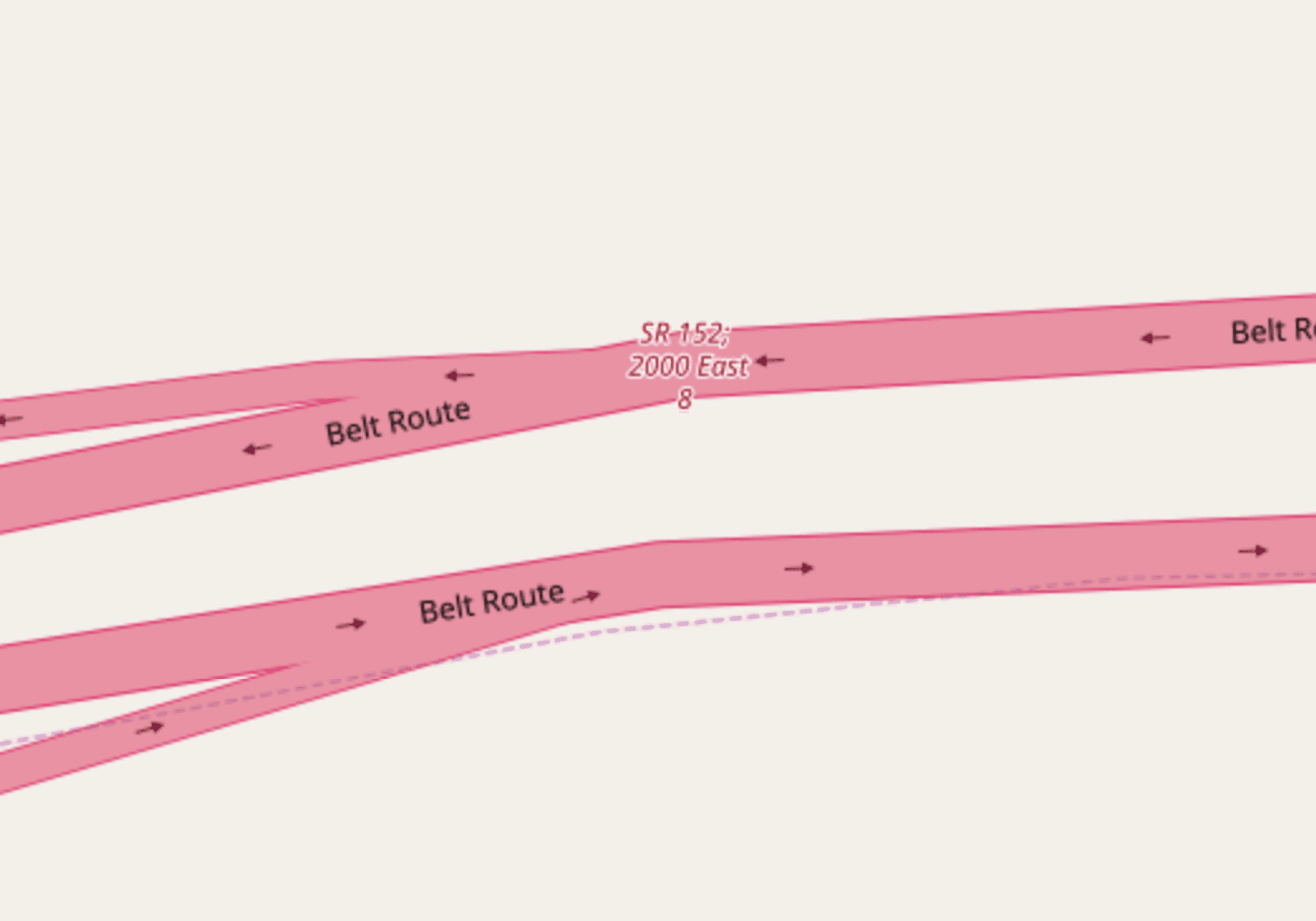
Here’s an example challenge that meets that criteria. We will ask mappers to review motorway_junction nodes in the United States that have name tags. This is uncommon in the U.S. Often mappers will add a name tag that has the destination information on it, so the information renders on the map:
This Overpass query selects all these nodes.
area[name="United States of America"]->.a; node["highway"="motorway_junction"]["name"](area.a); out meta;
With that query in hand, I can go to MapRoulette and click ‘Create’ at the top. This takes you to your MapRoulette Projects page. By default you will only have one Project. Click on its name to select it as the home for your new Challenge. At the top of the Project page, you will find the ‘Add Challenge’ link, click that to start the wizard to add a new Challenge.

The Wizard has 4 pages, but only the first two require your full attention
On the first page you enter the title, description and instruction for your challenge, as well as some metadata that will be used to help others find it and identify edits made by mappers using the Challenge:
- Visible Whether the Challenge will be listed. If no, you can still share the Challenge URL and it will work.
- Name A descriptive name for the challenge. I used Review named motorway junctions in USA. A good title describes what the challenge is about is a few words.
- Description Some text to describe in more words what the challenge is about. This field supports markdown and appears in the expanded challenge information when mappers browse for interesting challenges:
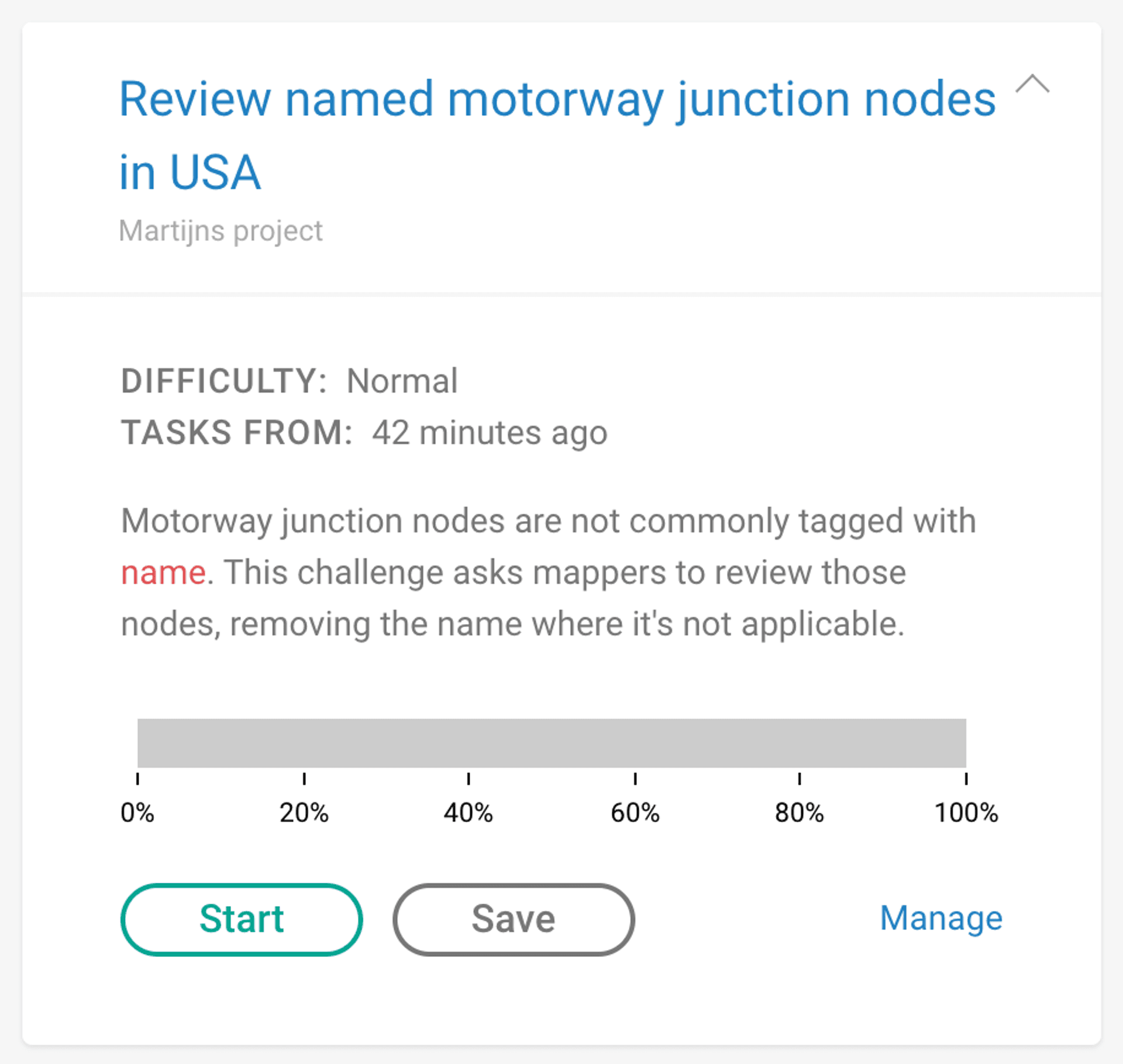
I used Motorway junction nodes are not commonly tagged with name. This challenge asks mappers to review those nodes, removing the name where it’s not applicable.
- Blurb Feel free to skip this. An even shorter description of what the challenge is about. I used Review named motorway junction nodes
- Instruction This is perhaps the most important text. Here you tell mappers exactly what the task is you want them to perform. Be specific and use links (this field supports markdown as well) to the OSM wiki or other external sources where needed. This text is shown next to the map of the task location. I used This
motorway_junctionnode has anametag. This is uncommon, see the OSM wiki for details. If this name tag does not represent a ‘name of the junction or interchange’, the name tag should be removed. If you’re not sure, you can skip the task… Note how I use markdown features to make the instructions easy to read and comprehensive. - Changeset Description This field will be used to pre-fill the changeset description in the editor ( A URL linking to the challenge description and task is automatically added to the changeset comment, but only when the challenge is discoverable ). I used reviewing named motorway junctions. A
#maproulettehashtag will be added unless you change that default setting below. - Changeset Source This field will be used to pre-fill the changeset source field in the editor. If your task involves using any external data, you should list it here. I used maproulette;overpass.
- Difficulty You can leave this at ‘Normal’ unless your tasks are particularly easy or hard. We may change this system in the near future.
- Category This helps the user find challenges they are interested in. There is a dropdown menu on the main Challenge list that lets users narrow down the list by category. For this challenge I used Roads / Pedestrian / Cycleways.
- Keywords These also help users find interesting challenges. They are used in the free text search field. I used
junction,name,motorwayandexit.
When all this is filled out, you can proceed to screen 2, where you supply the source data for the tasks. This can be a GeoJSON file or URL, or an Overpass query. If you use an Overpass query, make sure you don’t use any Overpass Turbo specific language such as geocodeArea:.... Test your query in Overpass Turbo first.
The final two screens let you add rules to prioritize certain tasks over others based on OSM tags, and let you define some view related settings for your challenge. The defaults are sensible but please do review them and tweak as needed. Make sure that the query only returns the nodes or ways that you want mappers to review, and ideally the number of objects returned should be no more than a couple thousand.
When you click ‘Finish’, MapRoulette will query Overpass in the background and populate your challenge. Depending on how heavy the Overpass query is, this can take a few seconds to a couple of minutes. When it finishes, you will see a map with your tasks, a complete list of tasks and some more challenge information.
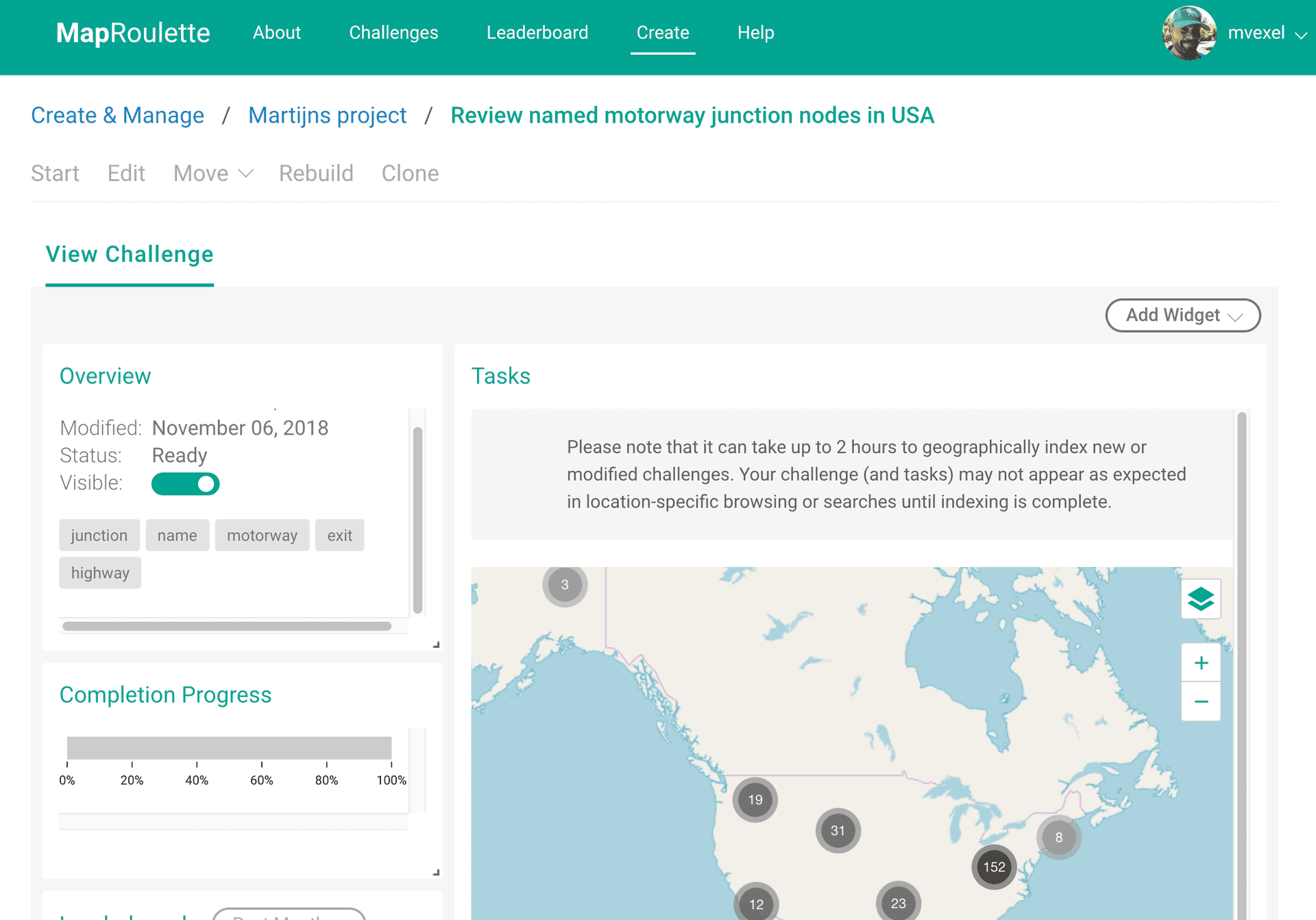
You can now click Start on the top to go directly to your challenge and try it out!